Stampede (Disaster Management)

Stampede (Disaster Management)

This article deals with ‘Stampede (Disaster Management).’ This is part of our series on ‘Disaster Management’, an important pillar of the GS-3 syllabus. For more articles, you can click here.


What is Stampede?

Stampede (Disaster Management)

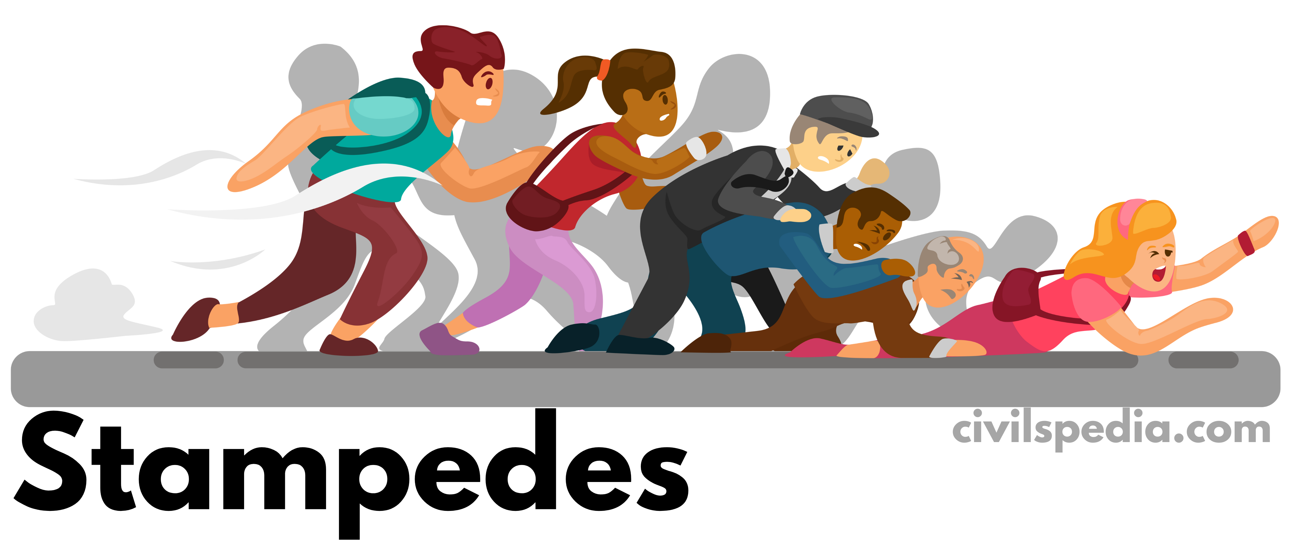
A stampede refers to a collective and chaotic rush of movement where a large group runs together without coordination, typically driven by a shared instinct to flee from a perceived danger.

Major Stampede Disasters in India

Stampede disasters include 

  • Uphaar Cinema ’97
  • Sabrimala stampede ’99
  • Railway Station Allahabad ’13 
  • Elphinstone Bridge Mumbai ’17 

Causes of Stampede

Structural factors and poor crowd control measures lead to stampedes.

1. Structural Factors  

  • Insufficient exits, narrow passageways, and poorly designed venues can impede the flow of people during events or emergencies, increasing the risk of stampedes.

2. Poor Crowd Management

  • Underestimation of the audience 
  • Crowd Behaviour: The influx of people in a gathering that triggers a stampede occurs when individuals perceive a threat or a lack of personal space. This disruption frequently hampers the organized flow of the crowd, resulting in chaotic and hazardous movements driven by the instinct to protect oneself. As a consequence, injuries and even deaths can occur.  

3. Panic and Fear

  • Stampedes can be triggered by panic and fear within the crowd. Factors such as sudden loud noises, rumours of danger, or perceived threats can create a sense of panic, causing people to rush and trample over each other in an attempt to escape the perceived danger. 

4. Poor coordination between Stakeholders

  • Stampede can happen due to a lack of understanding of the range of duties entrusted, communication delays, coordination gaps between agencies etc. 

Note: Deaths from stampedes occur primarily from compressive asphyxiation. 


Side Topic: Crowd Management

Stampede is closely associated with the concept of Crowd Management.

Crowd management is a strategy employed to maintain public safety by effectively handling and controlling large gatherings, aiming to avoid incidents such as stampedes, conflicts, violent clashes, uprisings, or dispersing assemblies, protests, or demonstrations.

The dynamics of crowds consist of a blend of voluntary and involuntary influences. 

  • When the density of a crowd is properly regulated, individuals within it are primarily influenced by voluntary forces.
  • But when the crowd density exceeds a critical threshold, people’s movements are compelled by involuntary forces, which involve physical pressures exerted by pushing from behind, the sides, or other directions in tightly packed circumstances. During stampede, involuntary forces are dominant.

Dealing with Stampede Disasters

According to NDMA guidelines 

  • Risk Analysis and planning should be the first step. All event organizers should conduct a Failure Mode and Effect Analysis (FMEA)
  • Information management dissemination is crucial. The absence or poor information management in itself may be a source of crowding.  
  • Capacity Planning (Long term and Short term): It emphasizes the need to develop infrastructure based on popularity, periodicity of the event, weather, terrain and local population. 
  • Understanding Crowd Behaviour: The behaviour of an individual in a crowd is influenced by the behaviour of others. The unlawful actions of a few people can result in a larger number following them. 
  • Crowd control-The guiding principle for crowd control should be managing the demand-supply gap by controlling the crowd inflow, regulating the crowd at the venue and controlling the outflow if needed. 
  • Stakeholder approach-organizers/law enforcement agencies must encourage community stakeholders (NGOs, Business Associations, Schools/Colleges, neighbourhoods, societies. Mohall committees etc.) to take ownership in events to uphold unity of purpose, faster decision/response, better coordination etc.  
  • Training: Training crowd management personnel, providing instructions on normal and emergency crowd movement and conducting mock drills is essential to prevent crowd disasters.
  • Technology: Use of Technology like remote sensing, GIS etc., to improve the crowd experience and crowd control.

Earthquakes (Disaster Management)

Earthquakes (Disaster Management)

This article deals with ‘Earthquakes (Disaster Management).’ This is part of our series on ‘Disaster Management’, an important pillar of the GS-3 syllabus. For more articles, you can click here.


Introduction

Earthquakes (Disaster Management)

The sudden release of energy in Earth’s crust, which leads to a series of motions due to waves created by the released energy, is called Earthquake. 


Earthquake Prone Regions

  • Tectonic Activity: The Himalayas are still evolving and adjusting to ongoing tectonic movements. The collision between the Indian plates and Eurasian tectonic plates creates immense pressure, resulting in frequent seismic activity in this region. The Himalayas are considered one of the most earthquake-prone regions in the world.
Himalayas- Why are they Earthquake Prone?
  • Gulf of Khambhat and Rann in Western Gujarat: The movement of the Arabian Plate against the Indian Plate contributes to seismic events.
  • Parts of Peninsular India, particularly along the Bhima Fault represented by the river Bhima near Latur, also experience significant seismic activity.
  • The islands of Lakshadweep and Andaman and Nicobar Islands are prone to earthquakes due to their proximity to major tectonic boundaries.
Mercalli Scale and India

Examples of Earthquakes

Some Great Earthquakes occurred in India.

1819: Gujarat 8.3 It caused widespread devastation
1897: Assam 8.7 This event led to extensive liquefaction in the alleviated plains of the Brahmaputra River.
1934: Bihar-Nepal 8.4 The impact of this earthquake was severe, with extensive liquefaction occurring and buildings tilting and slumping into the ground.
1967: Koyna 6.5 The construction of the Koyna Dam induced an earthquake measuring 6.5 on the Richter scale. The region was relatively aseismic before the dam’s construction in 1962. However, after the dam’s completion, seismic activity increased significantly.

Impact of Earthquake

Earthquake is a natural hazard. The following are the immediate hazardous effects of Earthquakes:

  • Ground Shaking 
  • Land and mudslides
  • Soil liquefaction. 
  • Ground lurching 
  • Avalanches 
  • Ground displacement 
  • Floods from dam and levee failures 
  • Fires.
  • Structural collapse
  • Falling objects
  • Tsunami.
  • Change in the course of the river
  • Human and property loss
  • Cracks in building 

Importance of Preparedness in Earthquakes

  • Disaster Preparedness is most important in case of Earthquakes because it can save a lot of lives. 
  • The most devastating earthquakes in terms of casualties are not necessarily the ones with the highest magnitudes on the Richter scale. Other factors, such as population density, building infrastructure, and preparedness levels, play a significant role in determining the outcome of an earthquake. The Haiti earthquake of 2010, measuring 7 on the Richter scale, serves as a tragic example. It claimed the lives of approximately 316,000 people due to a combination of factors, including a densely populated area and insufficient preparedness measures. 

Ways to deal with Earthquake

1. Disaster Risk Reduction (Before Earthquake)

1.1 Earthquake Resistant Buildings

  • Earthquake Resistant Buildings: Constructing buildings that can withstand seismic forces is crucial. Currently, around 80% of houses in India are not Earthquake resistant. Enhancing building standards and promoting earthquake-resistant construction techniques can significantly reduce casualties 
  • In the Bhuj Earthquake of 2001, RC buildings collapsed just an Earthquake of 7 on the Richter scale when RC buildings should stand up to 7.5

1.2 Seismic Codes

  •  India has a range of seismic codes that provide guidelines for constructing earthquake-resistant structures. However, enforcement of these codes is often lacking. Strengthening the implementation and enforcement of seismic codes is necessary to ensure the safety of buildings. 

1.3 Early Warning Systems

  • Developing and implementing early warning systems can provide valuable seconds to minutes of advance notice before an earthquake strikes. These systems use sensors to detect seismic waves and issue alerts, allowing people to take immediate protective actions and evacuate if necessary. 

1.4 Preparing Vulnerability Maps

  • Creating vulnerability maps of earthquake-prone areas can help identify higher-risk regions and guide decision-making processes. 

1.5 Educating People on How to Respond

  • Conducting mock drills and training sessions in highly vulnerable areas can educate people on earthquake response strategies. 

2. Disaster Response (During Earthquake)

2.1 Fast Response 

  • The time window for rescuing survivors after an earthquake is often narrow. Prompt response by emergency services is crucial. Establishing effective communication channels, coordinating rescue efforts, and deploying trained personnel quickly can increase the chances of saving lives.

2.2 Rescue Operations

  •  Immediate focus should be on clearing debris and locating individuals who are trapped or in need of help. Efforts should be made to find and extract survivors efficiently using specialized equipment and search-and-rescue techniques.

2.3 Relief

  • Providing temporary shelters, medical assistance, and essential supplies to injured individuals is essential. Ensuring that relief camps maintain proper hygiene standards is important to prevent the spread of diseases and minimize casualties. 

3. Recovery and Rehabilitation (After Earthquake)

3.1 Build Back Better

  • Build Back Better: After an earthquake, reconstruction efforts should aim to “build back better.” It involves incorporating seismic-resistant design principles and construction techniques in the rebuilding process. Learning from successful examples, like the reconstruction programs in Bhuj, India, can help create models for earthquake-resistant construction in other affected areas.

3.2 Psychological Services

  • Earthquakes can cause immense psychological trauma for those who have lost loved ones or witnessed the destruction. Providing psychological support services to affected individuals can aid in their recovery and help them cope with the emotional impact of the disaster.  

Case Study: Japan Model 

Japan is located in a seismically active region known as the Pacific Ring of Fire, making it highly prone to earthquakes. Over the years, Japan has developed an exemplary model of earthquake management that combines proactive measures, technological advancements, and public awareness. 

  1. Earthquake-Resistant Buildings: Japanese engineers and architects have devised innovative techniques and building codes to ensure structures can withstand seismic forces.
  2. Mock Drills: Regular mock drills are crucial in preparing Japanese citizens for earthquake emergencies. These drills are conducted at various levels, from schools and workplaces to entire communities. 
  3. Research and Development: Japan has established the Institute for Earthquake Research, an institution dedicated to studying earthquakes and developing cutting-edge technologies for earthquake management

Avalanches (Disaster Management)

Avalanches (Disaster Management)

This article deals with ‘Avalanches (Disaster Management).’ This is part of our series on ‘Disaster Management’, an important pillar of the GS-3 syllabus. For more articles, you can click here.


Introduction

  • Avalanches refer to the sudden and rapid sliding down of snow or ice on a mountain slope.
Avalanches  (Disaster Management)
  • Currently, avalanches have gained substantial importance, particularly in the regions of Leh and Siachen. These areas have witnessed a significant increase in the frequency of avalanches, leading to tragic and frequent loss of lives. The extreme conditions in these regions and the unique topography and weather patterns make them prone to avalanches. As a result, the lives of Army personnel on duty are continuously at risk.

Some Examples

2022 Uttarakhand Avalanche killed 10
2017 20 army personnel killed in avalanches which hit Kashmir’s Sonamarg and Gurez sector
2016 Avalanche in Siachin killing Army Personnel (including Lance Naik Hanumanthappa)

Factors causing Avalanche

Avalanches may occur due to a combination of various factors, with each contributing to the likelihood and severity of such events. Some of the key factors include:

  1. Global Warming: Global Warming is a significant factor influencing the occurrence of avalanches, particularly in recent times. Rising temperatures lead to changes in glacier characteristics, such as increased water content and altered stability, making slopes more prone to avalanches. 
  2. Slope of the Mountain: The steepness and angle of the mountain slope play a crucial role in determining avalanche susceptibility. Steeper slopes generally have a greater potential for avalanches.
  3. High Wind Velocity: Strong winds can significantly impact snow distribution and stability, contributing to avalanche formation.
  4. Vibrations Caused by Gunfire: Vibrations generated by gunfire or explosive activities can trigger avalanches. 
  5. Strength of resisting forces: When the balance between the gravitational force of snow cover and the resisting force of the slope, and the anchoring effect of shrubs are lost, avalanches are caused. 

Aftermath of Avalanche

The aftermath of an avalanche can be devastating, leaving behind a trail of destruction and impacting various aspects of life in the affected areas.

  1. Loss of Life: Avalanches can cause significant loss of life. Tragically, they can hit or bury human settlements. For instance, the Kashmir avalanche of 2005 claimed the lives of approximately 250 individuals. 
  2. Disruption of Transportation: Avalanches can block or destroy roads, making them impassable.
  3. Stranded Tourists: In popular tourist destinations located in mountainous regions, avalanches can pose a significant risk to visitors. When a major avalanche occurs, it can strand tourists in remote areas with limited facilities.
  4. Blockage of Small Rivers: Avalanches can also block small rivers or creeks due to the sheer volume of snow and debris. This blockage can lead to water accumulation upstream, creating the potential for downstream flooding. 

These consequences highlight the need for preparedness.


Mitigation Measures for Avalanches

Various mitigation measures can be implemented to minimize the risks associated with avalanches. 

Structural Measures

  • Planting (Avalanche Prevention Forest): Creating an Avalanche Prevention Forest involves strategically planting trees around settlements or vulnerable areas to serve as a protective cover. 
  • Avalanche Control Fence: Avalanche control fences are physical barriers designed to intercept and control the movement of snow during an avalanche event.
Mitigation Measures for Avalanches

Non-structural Measures

  • Removing snow deposits on slopes by blasting: Controlled blasting technique to trigger small avalanches and remove accumulated snow deposits from slopes before they become unstable.
  • Early Warning System: This system utilizes various monitoring technologies such as snowpack sensors, weather stations, and remote sensing to detect signs of potential avalanche conditions. India has still not installed Early Warning System, although Snow and Avalanche Study Establishment (SASE) is working on this.
  • While traveling in snow mountains, Wear an avalanche rescue beacon that signals your location.

By combining both structural and non-structural measures, communities and authorities can significantly reduce the risks associated with avalanches. 

Urban Fires (Disaster Management)

Urban Fires (Disaster Management)

This article deals with ‘Urban Fires (Disaster Management).’ This is part of our series on ‘Disaster Management’, an important pillar of the GS-3 syllabus. For more articles, you can click here.


Major Incidents

Urban Fires (Disaster Management)
  • 1997: Uphaar Cinema hall fire in New Delhi in which 59 people were killed as the exits had been blocked by unauthorized seating. 
  • 2016: Fire destroyed Delhi’s National Museum of Natural History, causing damage to anthropological heritage and specimens in it.
  • 2019:  17 people were killed in a fire at a five-storey hotel in Delhi.
  • 2021: Mumbai Dreams Mall Fire incident in which 10 people were killed. 


Causes of Urban Fires

  • Urban Issues: India’s urban areas often experience high population densities and rapid commercialization. It puts a strain on infrastructure and increases the risk of fires. 
  • Violation of Building Norms: The National Building Code in India provides guidelines for constructing buildings with adequate fire safety measures. However, these provisions are often violated due to weak administrative machinery and corruption. For example, The devastating fire at the AMRI Hospital in Kolkata in 2011, which resulted in the loss of many lives, was attributed to violations of building norms and a lack of adequate fire safety infrastructure.
  • Carelessness: Short circuits or faulty electrical appliances can trigger fires without proper precautions. For instance, in 2019, a fire broke out in a residential building in Delhi’s Karol Bagh area due to a short circuit. 
  • Problem with Fire Control Department: Shortages of fire stations, firefighting equipment, and trained personnel hinder effective fire control and response. Lack of resources and infrastructure was evident in the 2020 Bagree Market fire in Kolkata, where the blaze raged for over 60 hours due to the inadequate availability of firefighting resources.
  • Challenges in Slums or Illegal Settlements: Construction using inflammable materials, narrow lanes inhibiting the movement of fire control vehicles, and unsafe wiring are common issues in such areas. A notable incident occurred in 2015 when a fire broke out in a slum cluster in Mumbai’s Kalbadevi area.


Ways to Manage Urban Fires

Before the Disaster

  1. Preparedness Planning: Authorities and communities should develop comprehensive fire emergency plans, including risk assessments, evacuation strategies etc.
  2. Risk Mitigation: Proactive measures should be taken to reduce the risk of urban fires by implementing building codes and regulations, conducting inspections, promoting fire safety education etc.
  3. Early Warning Systems: Sophisticated fire detection systems and public alert mechanisms should be installed to provide timely warnings to residents.
  4. Infrastructure and Resource Development: Adequate infrastructure, including fire stations, hydrants, and firefighting equipment, should be strategically placed to ensure quick response times. 

During the Disaster

  1. Emergency Response: Fire departments and emergency services should respond promptly to the fire incident.  
  2. Evacuation and Sheltering: Evacuation plans are activated, and residents are guided to designated safe areas.   

After the Disaster

  1. Damage Assessment: Experts should assess the extent of the fire’s impact, including structural damage, infrastructure loss, and environmental hazards.  
  2. Lessons Learned and Training: Post-disaster evaluations should be conducted to identify areas for improvement in preparedness and response.  
  3. Build Back Better: The building that suffered such an incident should be constructed so that it is less vulnerable to fire.

Cyclones (Disaster Management)

Last Updated: July 2023 (Cyclones (Disaster Management))

Cyclones (Disaster Management)

This article deals with ‘Cyclones (Disaster Management).’ This is part of our series on ‘Disaster Management’, an important pillar of the GS-3 syllabus. For more articles, you can click here.


Introduction

Cyclones (Disaster Management)
  • With its vast coastline spanning approximately 7,500 kilometres, India is frequently affected by cyclones. The country experiences a significant share of the world’s tropical cyclones, accounting for nearly 10% of the global total.
  • The east coast of India is more susceptible to cyclones compared to the west coast. The Bay of Bengal, adjacent to the east coast, acts as a breeding ground for cyclones due to its warm waters and favourable atmospheric conditions. Hence, states such as Andhra Pradesh (AP), Odisha, Tamil Nadu, West Bengal, and the union territory of Puducherry, located along the east coast, face a higher risk of cyclonic activity. 
  • The west coast of India, although generally less prone to cyclones, also has its vulnerable areas. Gujarat is considered the most susceptible state on the west coast. The Arabian Sea, which borders the western region, can occasionally witness cyclonic disturbances threatening Gujarat and its coastal areas. 
Cyclone Prone Regions in India

Case Study: Super Cyclone (1999) vs Cyclone Phailin (2013)

The Super Cyclone and Phailin Cyclone case studies show the importance of preparedness.

Super Cyclone (Odisha, 1999) 

  • Wind speeds of 270-300 km per hour  
  •  10,000 people killed and lakhs of livestock population. 
  • Over 2 million houses were damaged.

But this damage could have easily been reduced.


Cyclone Phailin (2013)

  • Early Warnings were given to residents near Bhubaneshwar about an impending Cyclone which struck within a week 
  • Casualties were just 50 people dead 

Recent Cyclone Varda in Tamil Nadu & Cyclone Hudhood also showed a similar trend with a death toll not exceeding 10. But the damage to infrastructure is still high. Now reaching the next level, the concern is how to address losses occurring to property – roads, bridges, housing, hospitals, electricity etc. (Note: Sendai calls for a reduction in mortality and the destruction of infrastructure).


Impact of Cyclones

  • Human loss: Cyclones can have a devastating impact on human lives, leading to loss of life, injuries, and displacement. In India, the 1999 Super Cyclone (Odisha) caused over 10,000 deaths and affected millions of people. 
  • Economic Impact: Cyclones can cause significant economic losses. For instance, Cyclone Amphan, which hit India and Bangladesh in 2020, caused an estimated economic loss of around $13 billion. 
  • Loss of Livelihood: Coastal communities often bear the brunt of cyclones. In India, the communities dependent on fishing face severe challenges during cyclones. For example, in the aftermath of Cyclone Phailin in 2013, fishing was prohibited in coastal areas of Odisha, impacting the livelihoods of thousands of fishermen and their families. They lost access to food and clean drinking water and suffered from a loss of income.
  • Structural Damage: Cyclones can cause extensive damage to infrastructure, including roads, bridges, buildings, and other public facilities. Hurricane Katrina, 2005 in the United States, is a notable example of the significant structural damage caused by a cyclone.
  • Floods: Cyclones often bring heavy rainfall, leading to widespread flooding. It can result in the displacement of communities, damage to homes and infrastructure, and the spread of waterborne diseases.
  • Agricultural Damage: Cyclones can have a detrimental impact on agriculture, causing the destruction of crops and farmland. Cyclone Nargis, which struck Myanmar in 2008, caused extensive damage to the country’s agriculture sector, resulting in food shortages and increased vulnerability for the population.


Plan to tackle Cyclones

Disaster Risk Reduction (Before Cyclones)

  • Cyclone Disaster Management Plan: Develop an effective Cyclone Disaster Management Plan by analyzing historical data and conducting risk assessments.
  • Invest in Early Warning Systems: Enhance meteorological capabilities by investing in advanced technologies such as Doppler radar for accurate cyclone forecasting and warning services.
  • Cyclone Shelters: Identify vulnerable areas prone to cyclones and construct cyclone shelters equipped with necessary facilities to accommodate affected populations.
  • Maintain a fleet of machinery and vehicles ready for immediate deployment to assist in evacuating people to safer areas.
  • Mock Drills: Organize regular mock drills and training programs to educate and prepare the community for cyclone emergencies.

Disaster Response (During Cyclones)

  • Rapid dissemination of warnings: Government should disseminate the warning to the ports, fisheries, shipping agencies, and the general public to give time to these stakeholders to act.
  • Rapid Evacuation: Activate State Administration, National Disaster Response Force (NDRF), and Army personnel for swift evacuation operations, ensuring community participation and engagement.
  • Keep on providing the latest developments: Utilize various communication channels, with a special emphasis on radio broadcasting, to provide the latest and authenticated information regarding the cyclone, safety measures, and relief efforts.

Recovery and Rehabilitation (After Cyclones)

  • Build Back Better: Implement the “Build Back Better” principle by constructing houses, roads, and other infrastructure that are designed to withstand future cyclones and mitigate the impact of such disasters.
  • Rehabilitation: Provide necessary support for livelihood restoration, including financial assistance, vocational training, and employment opportunities, to help communities recover and rebuild their lives.

Side Note: Cyclone Shelters

One of the most successful ways of reducing the loss of human lives during cyclones is the provision of cyclone shelters. These buildings can be so designed so as to provide a blank façade with a minimum number of apertures in the direction of prevailing winds. The shorter side of the building should face the storm to impart the least wind resistance.


Indian Cyclone Early Warning System

  • The Indian Cyclone Early Warning System is an advanced meteorological system managed by the Indian National Centre for Ocean Information Services (INCOIS), which operates under the Ministry of Earth Sciences. 
  • The Indian Cyclone Early Warning System relies on the Doppler Effect to effectively detect and track cyclonic storms.
  • India has already installed 6 Doppler Radars on the East Coast, which is more vulnerable to the Cyclones.

Landslides (Disaster Management)

Last Updated: July 2023 (Landslides (Disaster Management))

Landslides (Disaster Management)

This article deals with ‘Landslides (Disaster Management).’ This is part of our series on ‘Disaster Management’, an important pillar of the GS-3 syllabus. For more articles, you can click here.


Introduction

Landslides (Disaster Management)
  • A landslide is a geological phenomenon characterized by the sudden movement of large masses of rocks, debris, or Earth down the slopes of mountains or hills. 
  • This natural event occurs when the stability of the slope is compromised, leading to the downward displacement of materials. Landslides frequently occur in conjunction with other natural disasters, such as earthquakes, floods, and volcanic eruptions. 
  • In the case of India, it is considered one of the top five countries globally that are prone to landslides. The combination of steep slopes, heavy monsoon rains, seismic activity, and human activities such as deforestation and improper land use practices further increases the risk of landslides in India.

Reasons for Landslides

  1. Geological Causes: The presence of weak, sensitive, and weathered materials on slopes makes them more prone to landslides. 
  2. Morphological Causes: Tectonically active mountainous regions are inherently more susceptible to landslides due to the constant movement of the Earth’s crust. 
  3. Global Warming: Intense and prolonged rainfall can saturate the soil, reducing its stability and triggering landslides. The rising global temperatures also contribute to permafrost degradation in cold regions, causing the ground to become unstable and prone to landslides.
  4. Large-Scale Construction in Hilly Areas: Extensive construction activities in hilly regions, dynamite blasting and the vibrations caused by heavy machinery during construction can weaken the slopes, resulting in landslides.
  5. Large-Scale Deforestation: Indiscriminate cutting down of trees in hilly areas has adverse effects on slope stability as trees play a crucial role in anchoring soil with their roots.


Main places of occurrence in India

Landslide Prone Areas in India

The Himalayas and Western Ghats are prominent regions prone to landslides due to various geological and environmental factors.

1. Himalayas

  • The Himalayas, characterized by their tectonically unstable younger geological formations, are particularly vulnerable to landslides. Factors like heavy rainfall and human activities (like excessive construction, deforestation and quarrying) also increase the likelihood of landslides.
  • One notable example is the Malpa landslide in 1998, which resulted in significant loss of life and property. In recent years, Uttarakhand has witnessed a high incidence of landslides.

2. Western Ghats

Western Ghats, bordering Tamil Nadu, Karnataka, Kerala, and the west coast of India, are relatively more tectonically stable. However, despite being composed of hard rocks, landslides and debris avalanches do occur in this region because

  •  The Western Ghats have steeper slopes with almost vertical cliffs, which contribute to the instability of the terrain. 
  • Mechanical weathering resulting from temperature changes and the heavy rainfall received over short periods further increase the susceptibility to landslides.

The topography of hilly regions, including the Himalayas and the Western Ghats, makes them inherently prone to landslides. However, human activities such as deforestation, quarrying, and poorly planned land-use changes exacerbate the vulnerabilities of these areas, especially during episodes of heavy rainfall.


Consequences

Destruction of Infrastructure 

  • Roadblock: Landslides can result in the sudden collapse of slopes onto roads and highways, causing blockages and hindering transportation.
  • Destruction of houses and infrastructure: The force exerted by a landslide can demolish structures in its path, resulting in the loss of property and endangering human lives.

Diversion of River Courses

  • In some cases, landslides can alter the natural flow of rivers and streams. When large volumes of soil and rock slide into water bodies, they can dam or divert the course of rivers, leading to flooding in previously unaffected areas.

Impact on Tourism and Livelihood

  • Landslides can have a significant impact on local economies that rely on tourism. 

Environmental Impact

  • The displacement of soil and vegetation can disrupt ecosystems, leading to habitat loss and changes in biodiversity. 
  • Introducing large amounts of sediment into water bodies can degrade water quality, affecting aquatic life and posing risks to human health.

Measures to control Landslides

Measures to control Landslides

Vegetation and Afforestation

  • Planting and maintaining vegetation on slopes can help stabilize the soil and prevent erosion.

Slope Stabilization Techniques

  • Various engineering techniques can be utilized to reinforce unstable slopes. These may include retaining walls, soil nailing, rock bolting, geotextiles, and ground anchors.

Early Warning Systems

  • Installing monitoring equipment such as inclinometers, piezometers, and ground movement sensors can help detect changes in slope stability and provide timely alerts, allowing people to evacuate.

Micro Zonation and Disaster Mapping

  • Identifying hazard-prone zones through geological surveys and micro zonation is crucial for regulating development and preventing the establishment of vulnerable infrastructure.

Proper Governance

  • Construction activities on the hill slopes should be fully regulated. In Uttarakhand, the main cause of landslides is the rampant building of hotels & other buildings on hill slopes in the wake of the tourism boom. 

Terrace Farming

  • Terrace farming should be encouraged instead of Jhumming (Slash and Burn/Shifting Cultivation).

Sustainable Tourism Practices

  • Sustainable tourism practices should be promoted in regions prone to landslides. It includes regulating tourism-related construction activities, ensuring adherence to building codes, and enforcing environmental guidelines

Personal Measures

  • Avoid traveling to hilly places during the rainy season  

Heat Waves (Disaster Management)

Heat Waves (Disaster Management)

This article deals with ‘Heat Waves (Disaster Management).’ This is part of our series on ‘Disaster Management’, an important pillar of the GS-3 syllabus. For more articles, you can click here.


Introduction

  • A heat wave refers to a period in the summer months when temperatures rise significantly above the usual maximum temperature.
  • Countries declare heat waves differently. Indian Meteorological Department declares a Heatwave when
    • departure of 4.5 to 6.4 degrees from the normal is considered a heat wave, while a departure above 6.4 degrees C is considered a severe heat wave.  
    • If the normal temperature of the station is more than 45°C (or 37°C at Hill Station), then a heat wave is to be declared irrespective.  
Heat Waves (Disaster Management)
  • Heat waves predominantly occur in India between March and June and occasionally, in rare instances, even extend into July. The month of May is the peak period for heat waves in India.

Causes of Heat Waves

1. In North-Central India

  • In North-Central India, heat waves are commonly observed during summer when an area experiences high pressure ( typically formed by Jet Streams). Heat waves occur due to trapped air caused by the downward force of high-pressure systems. This force prevents the air near the ground from rising, creating a cap-like effect that traps warm ground air in place. 
  • Loo: The dry and hot westerly winds originating from Baluchistan, central Pakistan, and the Thar Desert play an important role in the occurrence of heatwaves.

2. In Coastal Areas

  • Coastal areas near the Bay of Bengal frequently encounter a significant number of heat waves due to a phenomenon known as the Matsuno-Gill Response. This response occurs when the sea surface temperature of the Bay of Bengal decreases, leading to the development of low pressure over the area during summers. Consequently, the absence of sea breeze flowing from the Sea towards the land disrupts the moderating effect on the climate in coastal areas, resulting in the formation of heat waves.

3. In Cities

  • Urban areas experience the Urban Heat Island Effect, where cities tend to become hotter due to an abundance of cement and concrete and a lack of tree cover. This effect exacerbates the situation by causing ambient temperatures to feel 3 to 4 degrees Celsius higher than they actually are.

4. Green House Gas (GHG)

  • GHGs contribute to the retention of heat in the Earth’s atmosphere. A stronger greenhouse effect reduces the amount of heat radiation from the Earth that can escape into space.

Impacts of Heat Waves

  • Heat Stroke and Heat Exhaustion: Heat waves pose a significant risk of heat stroke and heat exhaustion. 
    • Heat stroke occurs when there is continuous and prolonged exposure to high temperatures, leading to symptoms such as nausea and heat cramps. This condition can result in a rapid rise in body temperature, which can be life-threatening if not treated promptly. 
    • Heat exhaustion, on the other hand, is caused by dehydration due to excessive sweating and inadequate water intake during hot weather.
  • Risk of Wildfires: Prolonged heat waves can increase the risk of wildfires. As the heat wave continues, the lack of moisture in the environment dries out vegetation, creating ideal conditions for the ignition and spread of forest or brush fires.
  • Drought Conditions: Heat waves exacerbate drought conditions. Soaring temperatures during the dry season intensify the impact of water scarcity, affecting millions of people. 
  • Prevents Cloud Formation: Heat waves can hinder cloud formation. The hot and dry conditions suppress the formation of clouds, reducing the chances of rainfall. 
  • Impacts on Outdoor Workers: Heat waves severely threaten outdoor workers, particularly labourers and poor farmers who have no choice but to work in blistering conditions. These individuals are at a higher risk of heat-related illnesses and fatalities due to prolonged exposure to extreme heat.
  • Increased Energy Demands: Sweltering heat waves lead to a surge in energy demand, particularly electricity


Tips to tackle Heat Waves

Institutional

  1. Raise awareness among citizens about the effects of heat waves.
  2. Implement effective warning systems.
  3. Enhance the skills of healthcare professionals to handle heat wave-related situations.
  4. Modify school and college schedules to conduct classes in the early morning.
  5. Temporarily suspend public wage programs like MGNREGA during the hottest hours of the day (11:30 am to 3:30 pm).


Personal

  1. Stay indoors and avoid direct sunlight, especially during the afternoon period from 11 am to 4 pm.
  2. Utilize air conditioners and coolers to keep cool during this time.
  3. When venturing outside, protect yourself from sunstrokes by wearing a hat and loose clothing.
  4. Stay hydrated by consuming ample amounts of water and fluids. At home, opt for fruit juices and chilled milk smoothies.
  5. When excessive sweating occurs, replenish lost salt and minerals using ORS (Oral Rehydration Solution) and electrolytes.

Tsunami (Disaster Management)

Tsunami (Disaster Management)

This article deals with ‘Tsunami (Disaster Management).’ This is part of our series on ‘Disaster Management’, an important pillar of the GS-3 syllabus. For more articles, you can click here.


Introduction

Tsunami (Disaster Management)

Tsunamis are natural phenomena characterized by the occurrence of large waves in the ocean. These immense waves are primarily generated by sudden movements of the ocean floor, which cause a significant displacement of water. 


Causes of Tsunami

  • Underwater Earthquakes: When an earthquake occurs, particularly if it originates under the ocean or near a coastline, it can lead to the generation of a tsunami. The seismic activity causes the ocean floor to shift abruptly, displacing enormous water. This displacement sets off a series of powerful waves propagating across the ocean, potentially reaching distant shores with devastating consequences.
Formation of Tsunami

  • Submarine or Terrestrial Landslides: When a significant amount of sediment or rock collapses into the ocean, it displaces water and propagates outward waves.
  • Volcanic Eruptions: Underwater volcanic eruptions can cause substantial disturbances to the ocean floor, leading to water displacement and tsunami formation. Similarly, volcanic collapses or explosions on islands or coastal areas can also generate tsunamis as the force of the eruption interacts with the surrounding water.
  • Asteroid, Meteor, or Comet Strikes: In rare cases, tsunamis can be triggered by bolide impacts, such as asteroid, meteor, or comet strikes. These celestial bodies possess immense kinetic energy, and when they collide with the Earth’s surface or enter the ocean, they create a tremendous displacement of water, resulting in waves propagating outward, forming a tsunami. 

India and Tsunamis

The phenomenon of a tsunami, typically caused by earthquakes near seismically active areas in the Pacific Ocean, was historically uncommon in India. However, in December 2004, India was struck by a devastating tsunami on its east and west coasts, resulting in significant consequences.

  • Waves were  3-10 m high and penetrated 300 metres to 3000 metres inland. 
  • Severe damage to life and property => confirmed death toll in India was 12,405 & 5,640 people are still unaccounted for. 
  • Maximum damage was observed in areas which destroyed their mangroves, forests & doing illegal mining.
  • However, Village Naluvedapathy experienced minimum destruction as they planted trees on the coast. 

Ways to deal with Tsunami

Disaster Risk Reduction (Before Tsunami)

  1. Setting up Early Warning Systems: Installing advanced monitoring equipment and establishing a reliable communication network to detect tsunamis and provide timely warnings to coastal communities.
  2. Structural Mitigation Measures: Constructing sea walls and breakwaters along vulnerable coastal areas to provide a physical barrier against incoming tsunami waves
  3. Mock Drills: Organizing regular mock drills and evacuation exercises to practice emergency response procedures and familiarize residents with evacuation routes and shelter locations.
  4. Planting trees along the coast: Due to the protective benefits of coastal vegetation, such as trees, mangroves, forests, sand dunes, and coastal cliffs. 
  5. Avoiding the destruction of Natural Barriers: Implementing policies and regulations to prevent the destruction of mangroves, forests, sand dunes, and coastal cliffs, as they act as natural buffers against tsunamis.
  6. Setting up proper Administrative Machinery: Establishing efficient administrative systems responsible for monitoring, issuing warnings, and coordinating quick and efficient responses.  

Disaster Response (During Tsunami)

  1. Rapid dissemination of Warnings: Ensuring the prompt transmission of tsunami warnings to relevant authorities, including ports, fisheries, shipping industries, and the general public, using various communication channels.
  2. Quick Evacuation System: Conducting evacuations promptly and efficiently to move people away from the coastal areas to safer locations.
  3. Helping survivors immediately after the Tsunami: Mobilizing emergency response teams to provide immediate assistance to survivors, including medical aid, search and rescue operations, and essential supplies like food, water, clothing, and temporary shelter.

Recovery and Rehabilitation (After Tsunami)

  1. Providing Livelihood Support: Offering assistance and support to affected communities in rebuilding their livelihoods by providing financial aid, vocational training, and resources to help restore businesses.
  2. Providing Housing: Assisting in the reconstruction and rehabilitation of housing for those who have lost their homes in the tsunami. It may involve building resilient and tsunami-resistant structures. 

Indian preparedness for Tsunami

The Indian government has shown significant commitment to enhancing its preparedness for tsunamis.

  1. Tsunami Early Warning System: The system has been designed to detect and provide warnings within 10 minutes of a submarine earthquake, providing time for the administration to start the evacuation process.
  2. Indian National Centre for Ocean Information Science (INCOIS): It is headquartered in Hyderabad and plays a pivotal role. It serves as the central hub from where all the monitoring and analysis of potential tsunami threats are carried out. 
  3. High Frequency (HF) Radars: These radars allow for the continuous monitoring of coastal currents, which helps in understanding the behaviour of the ocean currents and identifying any abnormal patterns that could potentially indicate the presence of a tsunami. 
  4. Strengthening Infrastructure: India has constructed coastal embankments, sea walls, and tsunami shelters in vulnerable areas to provide safe havens during emergencies.
  5. Public Awareness and Education: The Indian government has initiated extensive awareness campaigns to educate coastal communities about the risks and preparedness measures associated with tsunamis through various mediums such as television, radio, print media, and social media platforms along with Community drills, workshops, and training programs.

Urban Flooding (Disaster Management)

Urban Flooding (Disaster Management)

This article deals with ‘Urban Flooding (Disaster Management).’ This is part of our series on ‘Disaster Management’, an important pillar of the GS-3 syllabus. For more articles, you can click here.


Introduction

Urban Flooding  (Disaster Management)

Urban flooding refers to the situation in urbanized regions where there is an overflow of water due to inadequate drainage capacity. This occurs when stormwater accumulates in urban areas and is unable to find an outlet, leading to inundation and waterlogging.


Causes of Urban Flooding

  • Encroachment of Flood Plains, Mangroves, Wetlands, Lakes, etc.: Rapid urbanization has led to the encroachment and destruction of natural water bodies that act as natural buffers against flooding. For example, 
    • Bengaluru: There were 260 lakes in 1960 and 10 now
    • Mumbai: Mangroves and salt pans have been destroyed for constructing high-end residential buildings 
    • Chennai: Encroachment of wetlands and flood plains 
  • Unprecedented Rainfall: Indian cities experience heavy rainfall during the south-west monsoons. The average monthly rainfall in Mumbai in July is 868 mm. Such intense rainfall events overwhelm the drainage systems and cause urban flooding.
  • Cyclones and Hurricanes: India’s extensive coastline exposes it to tropical cyclones. The development of coastal cities and towns makes them vulnerable to inland flooding and storm surges caused by cyclones.
  •  Unpreparedness in Urban Planning: Many cities lack adequate urban planning and infrastructure to handle urban floods. Unlike cities like Tokyo, which have invested billions in building water discharge tunnels and advanced drainage systems, Indian cities often lack such preparedness.
  • Concretization of Cities: The extensive use of concrete and asphalt in urban areas reduces land permeability. It prevents water from seeping underground, increasing surface runoff and exacerbating the risk of urban flooding.
  • Urban Heat Island Effect: The phenomenon of urban heat islands, where cities experience higher temperatures than the surrounding countryside, can influence rainfall patterns. The hot air over cities can cause rain-bearing clouds to be pushed up, resulting in highly localized and intense rainfall events.
  • Global Warming: Climate change has led to unexpected and extreme changes in rainfall patterns. For instance, Chennai experienced unusually high rainfall in November 2015, with 1200 mm compared to the average of around 400 mm. 
Cities facing Urban Flooding in India

Case Studies

1. Global Examples

1.1 Kuala Lumpur

  • Kuala Lumpur, Malaysia’s capital city, has faced significant challenges with urban flooding due to its geographical location and heavy rainfall.
  • To address this issue, the city has implemented an innovative solution by constructing extensive water discharge tunnels. Tunnels divert excess floodwater away from the city’s densely populated areas. By creating an alternative pathway for water to flow, these tunnels alleviate the burden on the city’s drainage systems and prevent overwhelming floods.

1.2 Tokyo

  • Tokyo constructed a stormwater management system that includes the construction of reservoirs, underground storage facilities, and permeable surfaces to help capture excess rainwater and prevent it from overwhelming the drainage system.
  • Tokyo has prioritized the incorporation of green infrastructure, which can absorb rainwater and reduce runoff.
  • Installed Early Warning Systems

2. Indian Examples

2.1 Davangere (Karnataka)

Davangere faced recurring urban flooding due to heavy rainfall and inadequate drainage systems. To address this issue, the following was done.

  • Improved the city’s stormwater drainage infrastructure 
  • Desilted water channels
  • Created storage ponds and reservoirs to hold excess water during heavy rains temporarily 

2.2 Agartala (Tripura)

Agartala experienced significant urban flooding due to its geographical location and heavy rainfall patterns. To mitigate the impact of flooding, the city authorities adopted various measures. 

  • Construction of flood protection embankments and bunds along vulnerable areas
  • Development of rainwater harvesting structures, such as ponds and recharge pits, to capture and store rainwater, thereby reducing the burden on the drainage systems. 
  • Improved its sewage and stormwater drainage networks 

Disaster Management for Urban Flooding

Disaster Risk Reduction (Before Urban Flooding)

  1. Disaster Mapping: Conducting comprehensive risk assessments to identify vulnerable areas prone to flooding using geographical and historical data.
  2. Infrastructure Development: Constructing and maintaining flood protection infrastructure such as embankments, levees, and floodwalls and developing reservoirs, retention ponds, and water storage facilities for floodwater management.
  3. Early Warning Systems: Establishing advanced meteorological monitoring systems to predict heavy rainfall and extreme weather events and alert residents and authorities about impending floods.
  4. Conducting public awareness campaigns to educate residents about responding to incidents of urban flooding

Disaster Response (During Urban Flooding)

  1. Emergency Response: Activating emergency response teams and evacuating residents from high-risk areas to designated shelters or safer locations.
  2. Communication and Coordination: Establishing emergency helplines and control rooms to address queries and provide assistance.

Recovery and Rehabilitation (After Urban Flooding)

  1. Damage Assessment and Recovery: Conduct rapid damage assessments to determine infrastructure damage and losses.
  2. Long-Term Measures:
    • Conducting post-flood analysis and evaluating the effectiveness of existing flood management strategies.
    • Updating flood risk maps and revisiting urban planning regulations based on lessons learned.
  3. Capacity Building: Training and equipping local authorities and emergency response teams to handle future flood events effectively.

Measures Taken by the Government

1. Standard Operating Procedures (SOP) for mitigating Urban Flooding by the Central Government under the Atal Mission for Rejuvenation and Urban Transformation (AMRUT). It lays down a predefined set of directives or responsibilities for public agencies in a city/town in 3 phases: 

  1.  Pre-Monsoon Phase: Preparedness and Planning for Disaster Reduction.  
  2. During Monsoon Phase: Early Warning, Effective Response and Management, and Relief planning and execution
  3. Post-Monsoon Phase: Restoration and Rehabilitation.

2. Sponge Cities Plan by Urban Local Bodies and State Governments to make cities more permeable. Sponge cities involve the use of porous materials and technologies to improve the city’s capacity to absorb rainwater. E.g. use of permeable material for roads and pavement, contiguous open green spaces, green roofs, etc.

3. National Guidelines on Management on Urban Flooding by the National Disaster Management Authority (NDMA)   

Flood (Disaster Management)

Flood (Disaster Management)

This article deals with ‘Flood (Disaster Management).’ This is part of our series on ‘Disaster Management’, an important pillar of the GS-3 syllabus. For more articles, you can click here.


Introduction

Flood (Disaster Management)

The term “flood” is commonly used to describe a situation where the water flowing in rivers, streams, and other bodies of water cannot be contained within natural or artificial banks. 

Floods occur regularly in India, affecting approximately 10% of the country’s total area. However, the impact and frequency of floods have increased due to climate change.


Cause of Floods

Natural Causes

  • Heavy precipitation: India receives all the rainfall in just 4 months. During that period, the discharge of water in the river increases than the capacity of the river, resulting in floods.
  • The river changes its course due to various reasons, such as landslides. By blocking the flow of streams, the landslides cause massive floods.
  • Events such as cloud burst, which results in massive water discharge in a very less period
  • Climate Change: Climate Change led to increased variability in rainfall patterns, with some areas experiencing prolonged dry spells followed by heavy rainfall in a short period. This change in rainfall patterns contributes to flash floods.

Manmade Causes

  • Settlement in Flood Plains: Many towns and cities have been established in floodplains, which are low-lying areas adjacent to rivers and prone to flooding during heavy rainfall or when rivers overflow their banks.  E.g., Construction activities in low-lying areas, such as Alapuzha in Kerala, have made these regions highly vulnerable to flooding.
  • Destruction of Natural Wetlands around the Cities: Wetlands play a vital role in controlling floods by acting as natural sponges that absorb excess water during heavy rains. However, the destruction and encroachment of wetlands for urban development and agriculture have significantly reduced their capacity to absorb and store water. 
  • Environmental Degradation: The Gadgil report on the fragile ecosystem of the Western Ghats, released in 2011, highlighted the detrimental effects of illegal mining and deforestation in the region. These activities have led to extensive encroachment on river fronts, resulting in reduced river carrying capacity and increased siltation in reservoirs located in the Western Ghats. 
  • Deforestation and Soil Erosion: Deforestation, particularly in hilly regions and catchment areas, has a significant impact on flooding in India. Trees and vegetation help to retain rainwater, reduce surface runoff, and stabilize the soil. When forests are cleared for agriculture, urban expansion, or other purposes, the protective cover is lost, leading to higher rates of soil erosion. Increased soil erosion results in more sediment being carried by rivers, leading to siltation and reduced carrying capacity, which in turn contributes to floods.
  • Faulty Dam Management: Dam failures, the release of excessive water during heavy rainfall, or sudden discharges without adequate warning can lead to downstream flooding.  The 2018 floods in Kerala revealed shortcomings in dam management. The dam authorities were unable to assess the situation accurately and failed to provide timely warnings to the affected communities.

Side Topic: Flash Floods

Flash floods are an extreme manifestation of flooding that takes place within a significantly compressed timeframe, resulting in rapid and intense inundation. Unlike conventional floods that may unfold over a longer period and affect larger regions, flash floods are highly localized. 


Causes of Flash floods in India

  1. Cloudbursts: Cloudbursts are sudden, intense rainfall events that occur within a short period in localized areas that overwhelm drainage systems.
  2. The concentration of rainfall during the monsoon season: India receives nearly 75 per cent of its total rainfall during the monsoon season. This concentrated rainfall puts a significant burden on the rivers.
  3. Water exceeding the Dam’s Capacity: Flash floods can also occur when the water level in a dam exceeds its capacity. 
  4. Glacial Lake Overflow: In regions with glaciers, flash floods can be triggered by the overflow of glacial lakes. 

Factors like poor drainage infrastructure, deforestation, and urbanization can also exacerbate the risk of flash floods in certain areas.


Impacts of Floods

Negatives

  • Loss of life and property: Floods can lead to tragic loss of life and widespread destruction of homes, buildings, and infrastructure.
  • Damage to infrastructure: Floodwaters can cause significant damage to roads, bridges, railways, and other infrastructure. 
  • Mass Migration and Economic Disruption: In the aftermath of floods, people may be forced to evacuate their homes. This mass migration can disrupt the social fabric and economic activities.
  • Disease Outbreaks: Floods can create favourable conditions for the outbreak and spread of waterborne diseases, such as cholera, typhoid, and dysentery.
  • Public discontent and loss of trust: When floods occur frequently or result in extensive damage, people may become dissatisfied with the government’s response eroding their trust in the government’s ability to handle future disasters effectively. 

Positives

  • Increased Soil Fertility: Floods can deposit nutrient-rich sediments onto agricultural lands, improving soil fertility. 
  • Water Recharge of Natural Aquifers: Floodwaters can infiltrate into the ground, replenishing natural aquifers and underground water reserves. 
  • Renewal of Wetlands: Floods can play a vital role in renewing and restoring wetland ecosystems.

Ways to deal with Floods

Hard Management Techniques

  1. Dams: Dams play a crucial role in flood management by trapping and storing water during heavy rainfall or snowmelt periods. The stored water can then be released gradually during dry spells.
  2. Embankments or Artificial Levees: These structures are built along riverbanks to contain floodwaters within the river channel, preventing them from spilling into surrounding areas. 
  3. Interlinking of Rivers: Connecting rivers through canal systems or diversion channels can help manage floods by diverting excess water from one river to another.
  4. Flood Walls/Coastal Defences: These structures are constructed around settlements, particularly in coastal areas, to protect them from the impact of floods and storm surges.  
  5. Storage Areas: Constructing temporary storage areas, such as reservoirs or lakes, allows excess water to be pumped out of rivers during flood events.
  6. Dredging the River Basins: Dredging involves removing sediments, debris, and vegetation from river channels, increasing their capacity to carry water. 

Soft Management Techniques

  1. Washlands: Certain sections of the floodplain, known as washlands, are intentionally allowed to flood. These areas are often designated as sports fields or nature parks, serving as controlled flood zones.
  2. Flood Plain Zoning: This technique involves establishing regulations and land-use policies that restrict or discourage development in flood-prone areas.
  3. Afforestation: Planting trees and vegetation in flood-prone areas can help manage floods. The roots of trees absorb water and stabilize soil, reducing erosion and the likelihood of flash floods. 
  4. Warning Systems: Implementing early warning systems can provide timely information about impending floods.
  5. Hydrological Data Sharing: Cooperation and sharing of hydrological data among countries in the upper catchment area of a river basin are vital for effective flood management.

Capacity Building

  1. Flood Education: Raising awareness and providing education about floods, their causes, and appropriate responses can empower communities to better prepare and respond to flood events. 
  2. Emergency Search and Rescue: Developing specialized search and rescue teams trained in flood response can significantly improve emergency operations. 
  3. Emergency Relief: In the aftermath of a flood, providing short-term housing, food, safe water, access to healthcare, and protection for vulnerable groups such as women, children, and the elderly is essential. 

Other Measures

  1. There is a need to promote flood-tolerant “scuba rice”, sugarcane, jute and high-value aquatic crops in regions frequently hit by floods. 
  2. Formulate Nation-wide Silt Management Policy