Table of Contents
India State of Forests Report
This article deals with the ‘India State of Forests Report.’ This is part of our series on ‘Geography’, which is an important pillar of the GS-1 syllabus. For more articles, you can click here.
India State of Forests Report, 2021
- The Forest Survey of India (FSI) released the India State of Forest Report for 2021.
- FSI undertakes a biennial assessment of the country’s forest resources.
Definition of Forest
- According to FSI, all lands more than 1 hectare with a tree canopy of more than 10%, irrespective of the land usage, ownership or legal status of the land.
- The assessment is done using satellite data. The efficiency of this system is around 95%.
Types of Forest Cover
There are three types of Forest cover.
- Very Dense Forest: Tree canopy density of more than 70%
- Moderately Dense: Tree canopy density between 40% and 70%
- Open Forest: Tree canopy density of more than 10%
Issues with the System
- Plantations are also included in forest area, although they don’t provide the full benefits of forests and lacks biodiversity.
- Satellite data is not foolproof.
Key Highlights of the report
1. Forest and Tree Cover at the National level
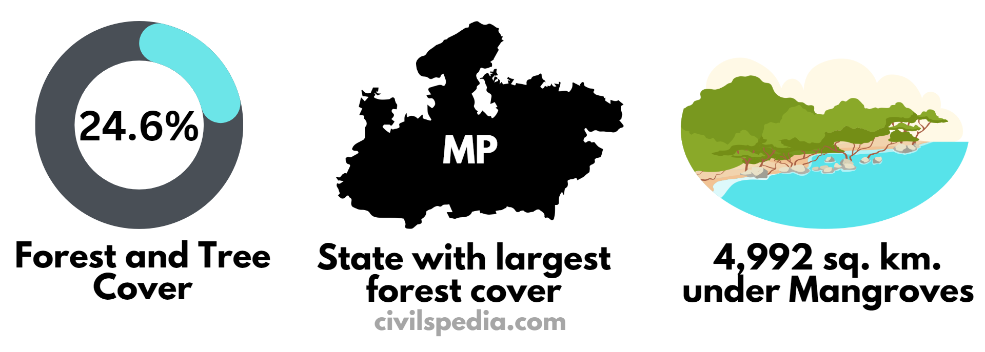
- India’s total Forest and Tree Cover is 80.9 million hectares, i.e. 24.62% of the Indian geographical area.
- It is an increase of 2,261 compared to the State of Forest Report of 2019.
2. Forest Cover in States
- The states with the largest forest cover are Madhya Pradesh, Arunachal Pradesh and Chhattisgarh.
- In terms of forest cover as a percentage, the top three States are Mizoram (85.41%), Arunachal Pradesh (79.63%), Meghalaya (76.33%)
- Andhra Pradesh, Telangana and Odisha witnessed the highest increase in forest cover.
- Arunachal, Assam, Manipur, Nagaland, Tripura, Mizoram, Meghalaya and Sikkim are the states showing the maximum loss in forest cover.
3. Mangroves
- The total mangrove cover in India is 4,992 sq. km.
- It has observed a net increase of 17 sq. km in the mangrove cover as compared to the 2019 assessment.
- The mangrove cover in the country is 0.15% of the country’s total geographical area.
- West Bengal has 42.45% of India’s mangrove cover, followed by Gujarat and the A&N Islands.
From 2017 Report
4. Forest Fires
- 21.40% of the country’s forest cover is high to extremely fire-prone.
- Most fire-prone forest areas are found in the north-eastern region and the central part of the country.
5. Biodiversity
- Maximum tree diversity is found in tropical evergreen forests of Western Ghats (Tamil Nadu, Kerala and Karnataka) followed by north-eastern states.