Last Update: June 2023 (Human Development Report)
Table of Contents
Human Development Report
This article deals with ‘Human Development Report’ This is part of our series on ‘Economics’ and ‘Society’. For more articles , you can click here .
Introduction
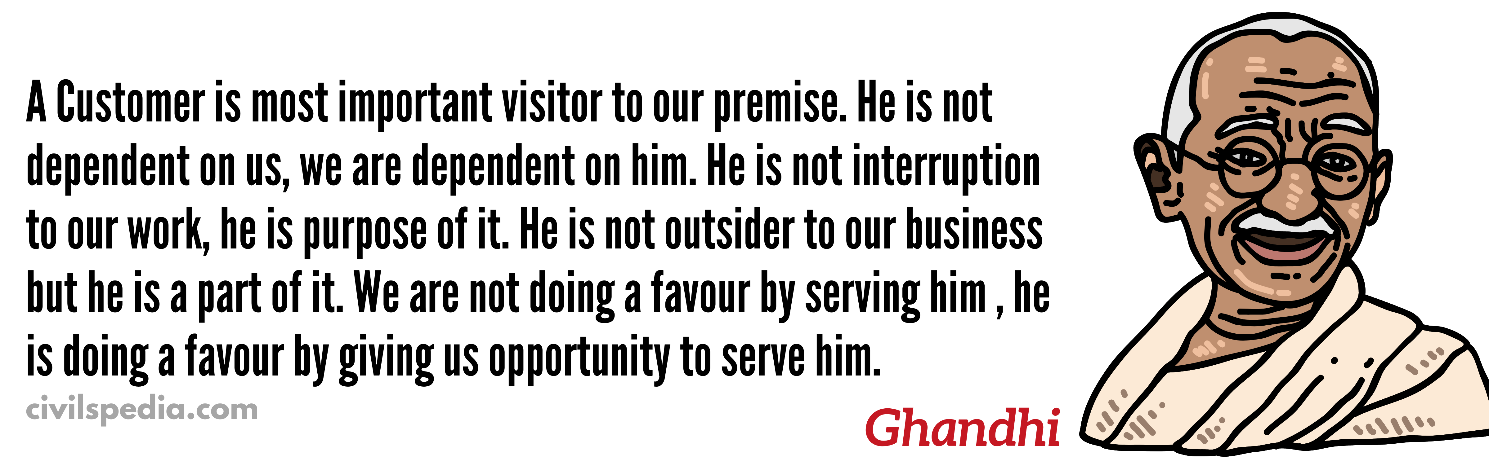
UNDP defines Human Development as the process of widening people’s choices and raising the level of well-being.
For instance, look at the following example.
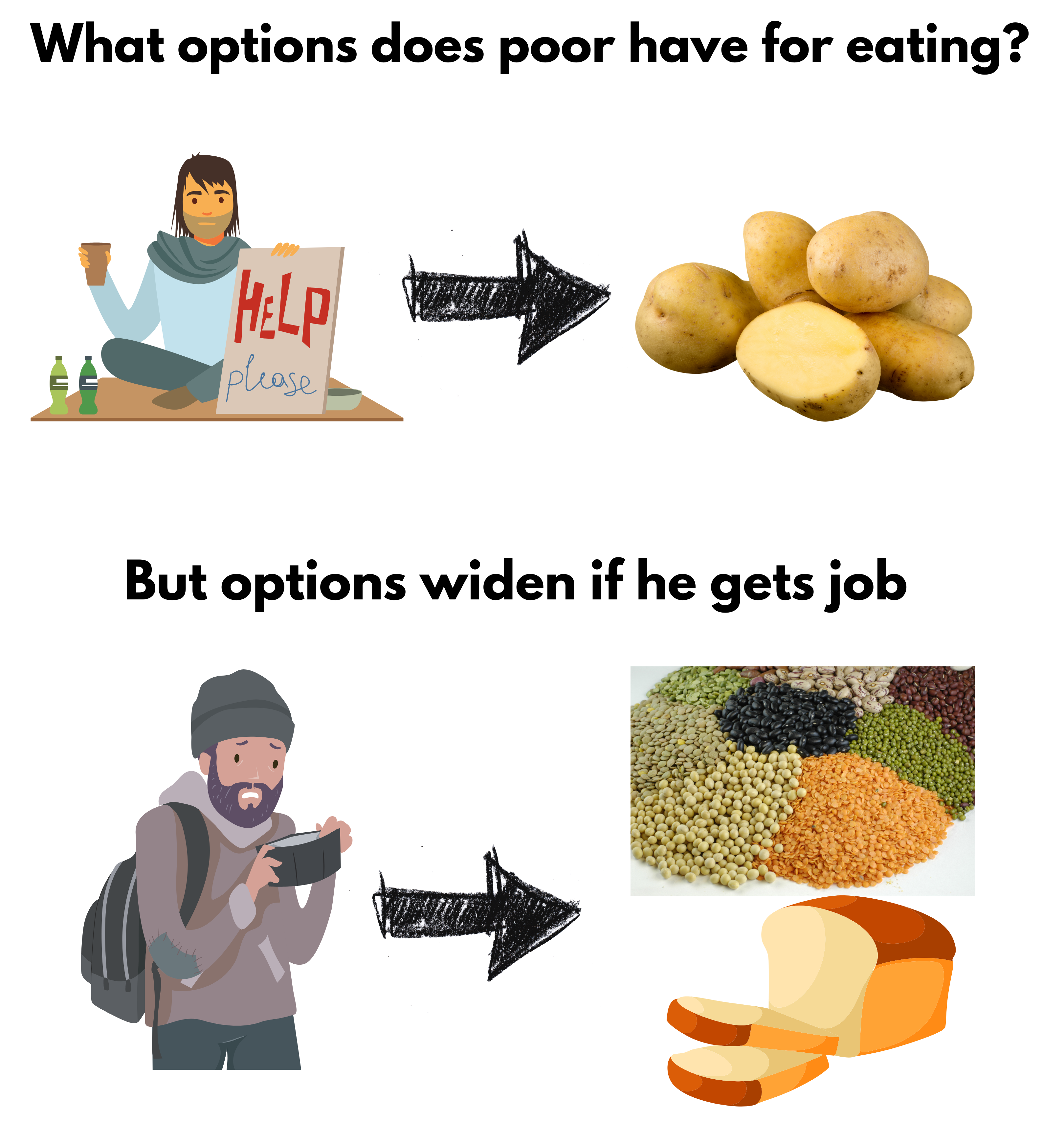
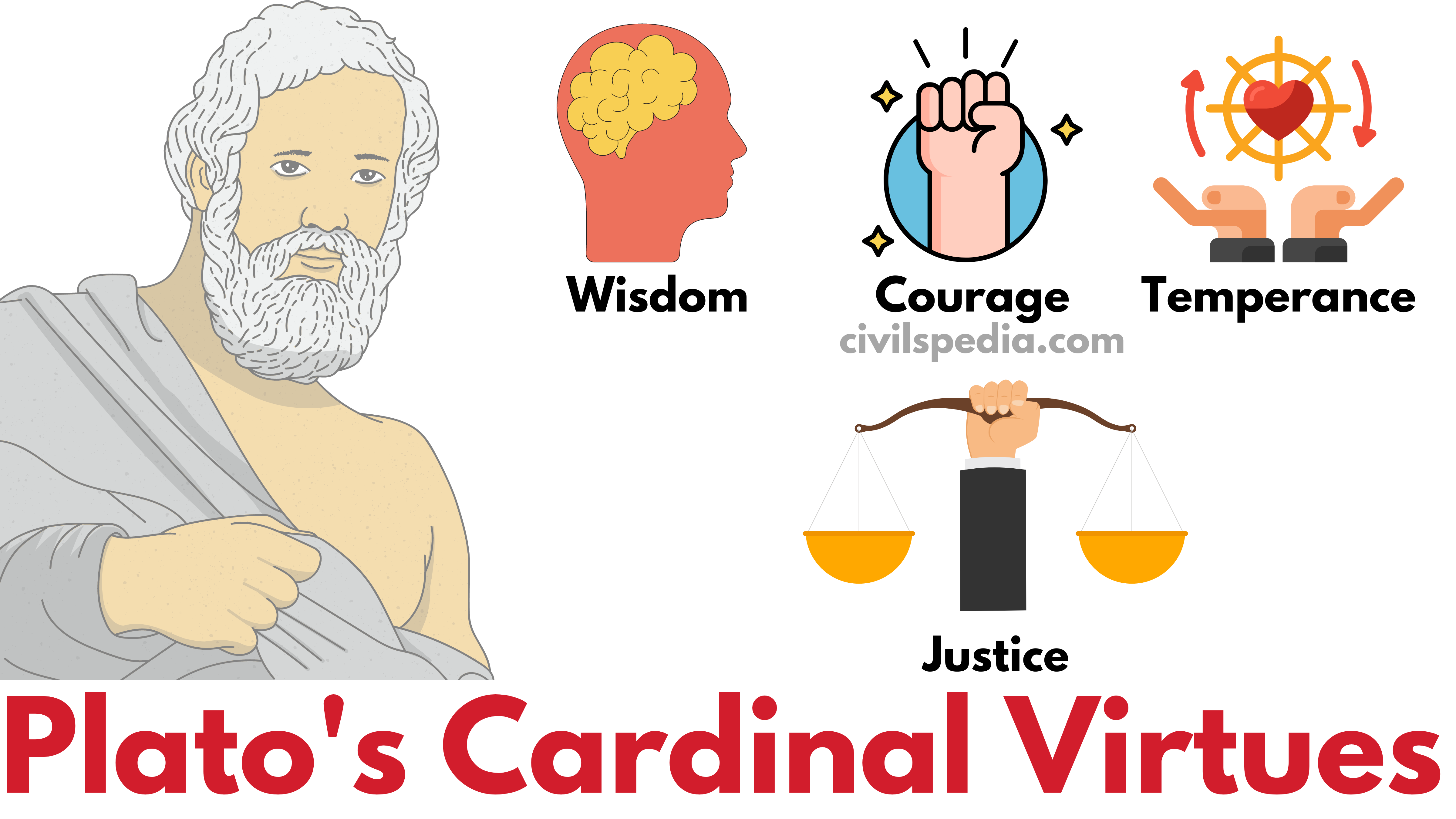
Human Development is the critical enabler for upward social mobility.
Human Development Report
- It is prepared by the United Nations Development Program (UNDP) which provides a comprehensive analysis of human development across countries.
- In 1990, Mahbub-ul-Haq of Pakistan and Amartya Sen of India gave the concept of HDI.
- In various reports, it has been found that the Human Development of everyone is not taking place.
- The human development of males is 20 points greater than females in South Asia.
- Everywhere, the Human Development of elites and religious majorities is more than others.
- Due to Climate Change, the Human Development of the present generation is more than what can be achieved by future generations.
In Human Development Report, there are 5 Indexes.
- Human Development Index (HDI)
- HDI – Inequality Adjusted
- Gender Development Index(GDI)
- Gender Inequality Index
- Multi-dimensional Poverty Index (MPI)
The latest report for 2021/22 was released in 2022
1. Human Development Index (HDI)
- It was developed by United Nations Development Program (UNDP) in 1990 by a team headed by Prof. Mahbub ul Haq. Prof Amartya Sen was also a prominent member of this.
Dimensions of HDI
| Dimension | Indicator |
| Health | Life Expectancy at Birth |
| Knowledge | – Mean Years of Schooling – Expected Years of Schooling |
| Standard of Living | GNI per capita |

- Switzerland topped the ranking in the latest report (2021/2022). India was ranked 132.
Indian Ranking
| Indian Ranking | HDI Score | |
| 1990 | 0.429 | |
| – | – | – |
| 2015 | 130 | 0.624 |
| 2016 | 131 | 0.624 |
| 2017 | 130 | 0.643 |
| 2018 | 129 | 0.647 |
| 2019 | 131 | 0.645 |
| 2021/22 | 132 | 0.633 |
Based on a report by the United Nations Development Program (UNDP), approximately 90% of nations have witnessed a decline in their Human Development Index (HDI) value during either 2020 or 2021. It signifies that global human development has come to a halt for the first time in 32 years.
2. Inequality-adjusted Human Development Index (IHDI)
- Human Development Index is Geometric Mean. Hence HDI masks internal inequalities.
- UNDP releases another Index which also accounts for inequalities.
- HDI (Inequality adjusted) = HDI -(minus) HDI (lost due to Inequality), i.e. Human Development which is lost because of inequalities present in the country wrt gender is adjusted in this.
IHDI (2022) Ranking
| Rank | Country | HDI Score | HDI-Inequality Adjusted Score |
| 1 | Iceland | 0.959 | 0.915 |
| 2 | Norway | 0.961 | 0.908 |
| —— | —– | ||
| 108 | India | 0.633 | 0.475 |
When there is perfect equality, the HDI and the Inequality Adjusted HDI (IHDI) are equal. However, as the difference between the two increases, it indicates greater levels of inequality within the country.
Note: SDG Goal 10 calls for ‘reducing the Inequalities.’
3. Gender Development Index
- The Gender Development Index (GDI) is a separate measurement released by the UNDP to complement the Human Development Index (HDI) to address females’ development specifically.
- While the HDI does not provide specific information on female development, the GDI calculates the ratio of Female HDI to Male HDI.
GDI = Female HDI/ Male HDI.
- If the Development Index for females exceeds that of males, the GDI can be greater than 1.
4. Gender Inequality Index
- The Gender Inequality Index (GII) has been calculated since 2010.
- Despite improvements in life expectancy and access to education for women, they still face specific forms of inequality, such as early pregnancies, lack of representation, and limited participation in economic activities. Therefore, the United Nations Development Programme (UNDP) introduced a specialized index to examine gender inequality.
Dimensions of Gender Inequality Index
| Dimension | Indicator |
| Reproductive Health | – Maternal Mortality Rate – Adolescent Birth Rate |
| Empowerment | – Parliament Seats occupied by Women – Higher Education Attainment Levels |
| Economic Activity | – Female Labour Force Participation |
The calculations used for the Gender Inequality Index (GII) are represented on a scale of 0 to 1, with 0 indicating no inequality (i.e., women fare equally to men) and 1 representing complete inequality (i.e., significant disparities between women and men).
GII (2022) Ranking
- India is Ranked = 122 (Score: 0.490)
- This score is better than that of the South Asian region (value: 0.508) and close to the world average of 0.465. This reflects the Government’s initiatives and investments towards more inclusive growth, social protection, and gender-responsive development policies.
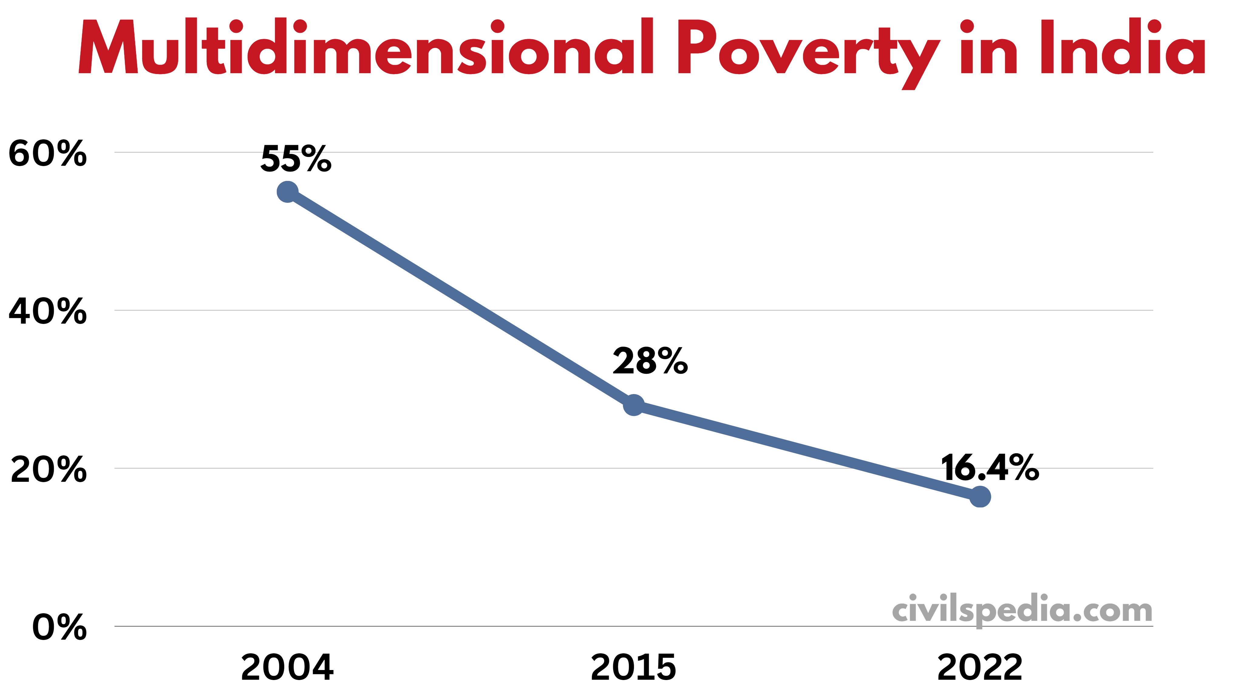
5. Multidimensional Poverty
- In India, we calculate poverty using Tendulkar Method based on household consumption.
- But UNDP takes a holistic view of poverty and measures it differently.
- The report has been released since 2010.
- In
Multidimensional Poverty, they look into the following components to
measure poverty (HES)
- Health with components like child mortality
- Education with components like years of schooling
- Standard of Living with components like electricity, water etc.
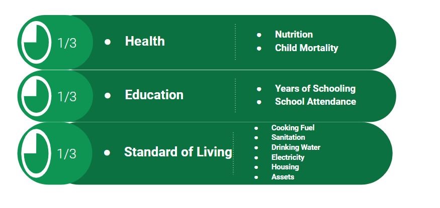
- According to the 2022 Report, 16.4 per cent of the Indian population (22.8 crores) is Multidimensionally Poor
- Additionally, Multidimensional Poverty is continuously decreasing in India.